
there is the map with its bonuses on it
i decided to scrap the controling spitsenbergen bonus
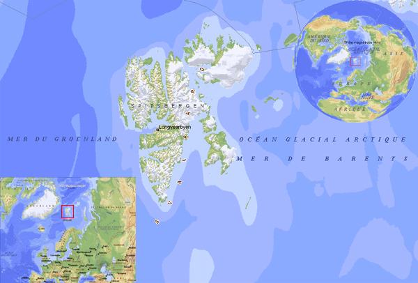
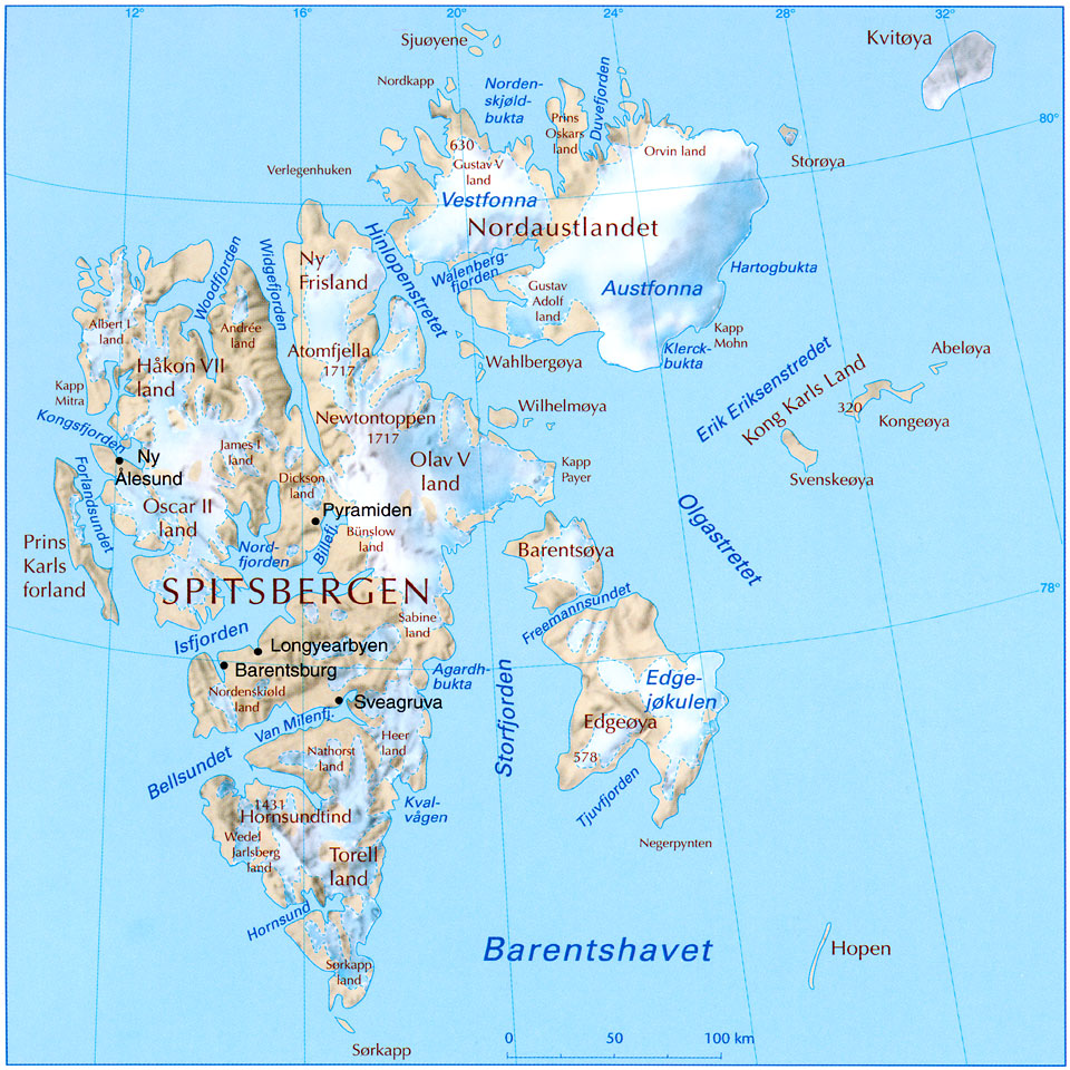
Svalbard map
Moderator: Cartographers
Forum rules
Please read the Community Guidelines before posting.
Please read the Community Guidelines before posting.
-
mightyal

- Posts: 280
- Joined: Fri Jul 14, 2006 12:33 pm
- Location: Banging the hag whilst Owl is busy banging hendy's mum
The name of the brown continent is unreadable. Not hard to read - I genuinely cannot read it.
Also (non-expert opinion), there are too many links between continents.
Also (non-expert opinion), there are too many links between continents.
"I do not feel obliged to believe that the same God who has endowed us with sense, reason, and intellect has intended us to forgo their use."
- Galileo Galilei
- Galileo Galilei
-
happysadfun

- Posts: 1251
- Joined: Mon Jul 10, 2006 9:06 pm
- Location: Haundin at DotSco, Being Sad that Mark Green Lost in Suburban Wisconsin
 Children, this is what happens to hockey players, druggies, and Hillary Clinton.
-
happysadfun
- Posts: 1251
- Joined: Mon Jul 10, 2006 9:06 pm
- Location: Haundin at DotSco, Being Sad that Mark Green Lost in Suburban Wisconsin

In order to make an original map, I would suggest to make the inland part of Svalbards a not playable area since they are covered by ice.
i like the ship draft you putted in the right down corner of the map..
So my idea would be to make Svalbard map a really sea map... using the insland only as harbours and using as territories many ships...
Maybe the theme of the map could be a scientific (and not only) competition between the nations that want to reach the north pole from Svalbards... you could aslo use the fact that on the main insland there's the northest university of the world....
you could also put some iceberg on the map... I don't know... just use your fantasy...
so, at end, I suggest a total change about the map ideas and goals...
have a look to theis map to take inspiration and to take some more accurate location name...
"Nature is a temple in which living pillars
Sometimes emit confused words;
Man crosses it through forests of symbols
That observe him with familiar glances."
Sometimes emit confused words;
Man crosses it through forests of symbols
That observe him with familiar glances."
i was planning to try and do a seasonal map but wa s not sure if it would be hard to do it
so some territories become blocked in winter by ice ect
i might pm lack and see if her could programme season in or something
the name i used are all from svalbard but not in the right places well some of them are
so some territories become blocked in winter by ice ect
i might pm lack and see if her could programme season in or something
the name i used are all from svalbard but not in the right places well some of them are
-
gavin_sidhu

- Posts: 1428
- Joined: Mon May 22, 2006 6:16 am
- Location: Brisbane, Australia

Because USA states are all inland with square boaders, and very little obstacles. This state is comprised of mainly islands with unique placements. Similar to some country maps, or even the classic mapgavin_sidhu wrote:Well i finally decided to wiki svalbard and find out about it, its a state in Norway. People get upset when states of the US are proposed, why does a state of Norway deserve to be mapped?


I also think it doesnt deserve it, even why we have other areas that could be more interesting.gavin_sidhu wrote:Well i finally decided to wiki svalbard and find out about it, its a state in Norway. People get upset when states of the US are proposed, why does a state of Norway deserve to be mapped?

-
gavin_sidhu
- Posts: 1428
- Joined: Mon May 22, 2006 6:16 am
- Location: Brisbane, Australia


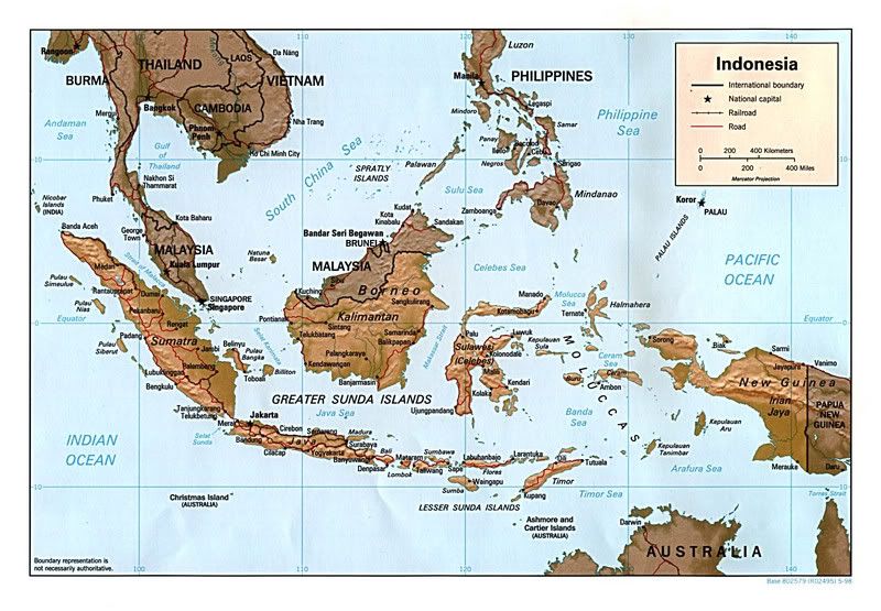
Indonesia maybe? Well, surely if population counts 
http://i44.photobucket.com/albums/f44/M ... ia_map.jpg
http://i44.photobucket.com/albums/f44/M ... ia_map.jpg
-
Puff

- Posts: 2551
- Joined: Wed Nov 29, 2006 12:05 pm
- Location: Underground. I won't say exactly where but if you want a clue all you must do is look down.
Re: Svalbard map
I have one question. Is Nosa apart of the Karls Land bonus?Telvannia wrote:firstly this will my last attempt (that is for all the people who might be bored of me starting a idea then giving up)
First Version
http://img237.imageshack.us/img237/2692 ... d16fz1.jpg
the title in the top left
Second Version
http://img296.imageshack.us/img296/1299 ... r17so7.jpg
A viking longboat in the bottom left in a diagonal direction
Third Version
http://img84.imageshack.us/img84/1351/svalbar18ay6.jpg
Forth Version
http://img325.imageshack.us/img325/1879 ... r19zj1.jpg
Fifth Version
put the key in the bottom right corner
(the white lines are attack routes via the sea)
and constructive comments only please
