[Abandoned] - The Hamptons
Moderator: Cartographers
Forum rules
Please read the Community Guidelines before posting.
Please read the Community Guidelines before posting.
-
rjz115dude
- Posts: 52
- Joined: Sun Dec 07, 2008 7:10 pm
-
Teflon Kris

- Posts: 4236
- Joined: Sun Jul 13, 2008 4:39 pm
- Gender: Male
- Location: Lancashire, United Kingdom
Re: Long Island v9 [D] pgs 1 & 14 (NEW: XML!!)
Haven't looked at this map for a while.
I think the lighthouses work much better game-play-wise than the boats did -plus more graphically appealing.
How about a couple of boats in dead space as well?
I think the lighthouses work much better game-play-wise than the boats did -plus more graphically appealing.
How about a couple of boats in dead space as well?
-
LED ZEPPELINER
- Posts: 1088
- Joined: Tue Nov 25, 2008 10:09 pm
Re: Long Island v9 [D] pgs 1 & 14 (NEW: XML!!)
DJ Teflon wrote:Haven't looked at this map for a while.
I think the lighthouses work much better game-play-wise than the boats did -plus more graphically appealing.
OK
How about a couple of boats in dead space as well?
As Territs, or as decoration?
sailorseal wrote:My big boy banana was out the whole time
AndyDufresne wrote:Forever linked at the hip's-banana! (That sounds strange, don't quote me.)AndyDufresne wrote:Many Happy Bananas to everyone, lets party...with Bananas.
--Andy
-
Teflon Kris
- Posts: 4236
- Joined: Sun Jul 13, 2008 4:39 pm
- Gender: Male
- Location: Lancashire, United Kingdom
Re: Long Island v9 [D] pgs 1 & 14 (NEW: XML!!)
I was thinking of the boats/ships as terits.
They could link the lighthouses in fact (getting round the 'slingshot' issue rightly raised).
You could also go for a bonus for holding the boats/ships. Possibly one lager ship (2/3 terits) that links to the others / can bombard other boats/ships/certain land terits.
If you do go for this I wouldn't advise too many - too avoid clutter - just an additional feature, graphically and gameplay-wise.
-
sailorseal
- Posts: 2735
- Joined: Sun May 25, 2008 1:49 pm
- Gender: Male
- Location: conquerclub.com
Re: Long Island v9 [D] pgs 1 & 14 (NEW: XML!!)
We tried boats but they were vetoedDJ Teflon wrote:I was thinking of the boats/ships as terits.
They could link the lighthouses in fact (getting round the 'slingshot' issue rightly raised).
You could also go for a bonus for holding the boats/ships. Possibly one lager ship (2/3 terits) that links to the others / can bombard other boats/ships/certain land terits.
If you do go for this I wouldn't advise too many - too avoid clutter - just an additional feature, graphically and gameplay-wise.
-
the.killing.44

- Posts: 4724
- Joined: Thu Oct 23, 2008 7:43 pm
- Gender: Male
- Location: now tell me what got two gums and knows how to spit rhymes
- Contact:
Re: Long Island v9 [D] pgs 1 & 14 (NEW: XML!!)
Yes, but that was before the lighthouses. I quite like the idea of adding ~6 boats that involve some link with the lighthouses.sailorseal wrote:We tried boats but they were vetoed
.44
-
LED ZEPPELINER
- Posts: 1088
- Joined: Tue Nov 25, 2008 10:09 pm
Re: Long Island v9 [D] pgs 1 & 14 (NEW: XML!!)
i was thinking of only having two boats, 1 on each coat (north and south), and having the three lighthouses all connecting to it
sailorseal wrote:My big boy banana was out the whole time
AndyDufresne wrote:Forever linked at the hip's-banana! (That sounds strange, don't quote me.)AndyDufresne wrote:Many Happy Bananas to everyone, lets party...with Bananas.
--Andy
-
Teflon Kris
- Posts: 4236
- Joined: Sun Jul 13, 2008 4:39 pm
- Gender: Male
- Location: Lancashire, United Kingdom
Re: Long Island v9 [D] pgs 1 & 14 (NEW: XML!!)
Sounds good - I would imagine any smallish number of boats would work - happy to support you with however many you feel fits.
Re: Long Island v9 [D] pgs 1 & 14 (NEW: XML!!)
sailorseal wrote:We tried boats but they were vetoedDJ Teflon wrote:I was thinking of the boats/ships as terits.
They could link the lighthouses in fact (getting round the 'slingshot' issue rightly raised).
You could also go for a bonus for holding the boats/ships. Possibly one lager ship (2/3 terits) that links to the others / can bombard other boats/ships/certain land terits.
If you do go for this I wouldn't advise too many - too avoid clutter - just an additional feature, graphically and gameplay-wise.
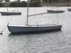
How about ferries which have docks at most light houses on long island.. i liked this map when it first came out .. only because i was born and raised here.. But from what i see now it is very boring and does not represent long island at all with the exception of the shape which is still off considerably.. Now i finally understand why the foundry members knock state based maps.. There is so much that can be added here..

-
sailorseal
- Posts: 2735
- Joined: Sun May 25, 2008 1:49 pm
- Gender: Male
- Location: conquerclub.com
Re: Long Island v9 [D] pgs 1 & 14 (NEW: XML!!)
We will add back some boats and I am not sure if a CC map can really embody a placedanfrank wrote:sailorseal wrote:We tried boats but they were vetoedDJ Teflon wrote:I was thinking of the boats/ships as terits.
They could link the lighthouses in fact (getting round the 'slingshot' issue rightly raised).
You could also go for a bonus for holding the boats/ships. Possibly one lager ship (2/3 terits) that links to the others / can bombard other boats/ships/certain land terits.
If you do go for this I wouldn't advise too many - too avoid clutter - just an additional feature, graphically and gameplay-wise.
How about ferries which have docks at most light houses on long island.. i liked this map when it first came out .. only because i was born and raised here.. But from what i see now it is very boring and does not represent long island at all with the exception of the shape which is still off considerably.. Now i finally understand why the foundry members knock state based maps.. There is so much that can be added here..
-
sailorseal
- Posts: 2735
- Joined: Sun May 25, 2008 1:49 pm
- Gender: Male
- Location: conquerclub.com
Re: Long Island v9 [D] pgs 1 & 14 (NEW: XML!!)
We are adding boats, is that alright with everyone?
There will only be a few, not as many as before
There will only be a few, not as many as before
-
LED ZEPPELINER
- Posts: 1088
- Joined: Tue Nov 25, 2008 10:09 pm
Re: Long Island v9 [D] pgs 1 & 14 (NEW: XML!!)
there will be exactly 6, you will see in the upcoming new versionsailorseal wrote:We are adding boats, is that alright with everyone?
There will only be a few, not as many as before
sailorseal wrote:My big boy banana was out the whole time
AndyDufresne wrote:Forever linked at the hip's-banana! (That sounds strange, don't quote me.)AndyDufresne wrote:Many Happy Bananas to everyone, lets party...with Bananas.
--Andy
-
LED ZEPPELINER
- Posts: 1088
- Joined: Tue Nov 25, 2008 10:09 pm
Re: Long Island v10 [D] pgs 1 & 15 (NEW LOOK)
Ok, so i completely changed the look of this map, i am going to leave the small out, just until game play is sorted out. I added the boats, and made it so every boat of the same color can assault each other. Should i have a bonus for the boats? and what do you think?
XML
v10

to do:
finish gameplay
changes:
1. new ocean
2. new land color
3. boats
4. no ocean names
5. moved the name of montauk
XML
Code: Select all
<?xml version="1.0"?>
<map>
   <title>Long Island</title>
   <smallwidth>630</smallwidth>
   <smallheight>325</smallheight>
   <largewidth>840</largewidth>
   <largeheight>430</largeheight>
   <filetype>jpg</filetype>
<continent>
   <name>Nassau</name>
   <bonus>3</bonus>
   <components>
      <territory>Hempstead</territory>
      <territory>Oyster Bay</territory>
      <territory>Cedarhurst</territory>
      <territory>Massapequa</territory>
<territory>Long Beach</territory>
<territory>Jones Beach</territory>
   </components>
</continent>
<continent>
   <name>Central Suffolk</name>
   <bonus>5</bonus>
   <components>
      <territory>Huntington</territory>
      <territory>Smithtown</territory>
      <territory>North Brookhaven</territory>
      <territory>Babylon</territory>
<territory>Bay Shore</territory>
<territory>Islip</territory>
      <territory>Patchogue</territory>
      <territory>South East Brookhaven</territory>
      <territory>Fire Island</territory>
   </components>
</continent>
<continent>
   <name>North Fork</name>
   <bonus>2</bonus>
   <components>
      <territory>Riverhead</territory>
      <territory>Southold</territory>
      <territory>Orient Point</territory>
   </components>
</continent>
<continent>
   <name>The Hamptons</name>
   <bonus>3</bonus>
   <components>
      <territory>West Hampton</territory>
      <territory>Roger’s Beach</territory>
      <territory>South Hampton</territory>
      <territory>Bridge Hampton</territory>
<territory>East Hampton</territory>
<territory>Shelter Island</territory>
<territory>Montauk</territory>
   </components>
</continent>
<territory>
   <name>Hempstead</name>
   <borders>
      <border>Oyster Bay</border>
      <border>Huntington</border>
      <border>Southold</border>
      <border>Massapequa</border>
<border>Cedarhurst</border>
   </borders>
   <coordinates>
      <smallx>45</smallx>
      <smally>244</smally>
      <largex>61</largex>
      <largey>318</largey>
   </coordinates>
</territory>
<territory>
   <name>Cedarhurst</name>
   <borders>
      <border>Hempstead</border>
      <border>Massapequa</border>
      <border>Long Beach</border>
   </borders>
   <coordinates>
      <smallx>51</smallx>
      <smally>267</smally>
      <largex>69</largex>
      <largey>348</largey>
   </coordinates>
</territory>
<territory>
   <name>Oyster Bay</name>
   <borders>
      <border>Massapequa</border>
      <border>Hempstead</border>
      <border>Huntington</border>
   </borders>
   <coordinates>
      <smallx>81</smallx>
      <smally>225</smally>
      <largex>109</largex>
      <largey>292</largey>
   </coordinates>
</territory>
<territory>
   <name>Massapequa</name>
   <borders>
      <border>Hempstead</border>
      <border>Cedarhurst</border>
      <border>Oyster Bay</border>
      <border>Huntington</border>
<border>Babylon</border>
   </borders>
   <coordinates>
      <smallx>81</smallx>
      <smally>225</smally>
      <largex>109</largex>
      <largey>292</largey>
   </coordinates>
</territory>
<territory>
   <name>Long Beach</name>
   <borders>
      <border>Cedarhurst</border>
      <border>Jones Beach</border>
      <border>Fire Island</border>
      <border>East Hampton</border>
   </borders>
   <coordinates>
      <smallx>53</smallx>
      <smally>312</smally>
      <largex>72</largex>
      <largey>408</largey>
   </coordinates>
</territory>
<territory>
   <name>Jones Beach</name>
   <borders>
      <border>Long Beach</border>
   </borders>
   <coordinates>
      <smallx>107</smallx>
      <smally>305</smally>
      <largex>144</largex>
      <largey>399</largey>
   </coordinates>
</territory>
<territory>
   <name>Huntington</name>
   <borders>
      <border>Oyster Bay</border>
      <border>Massapequa</border>
      <border>Babylon</border>
      <border>Bay Shore</border>
      <border>Hempstead</border>
      <border>Southold</border>
<border>Smithtown</border>
   </borders>
   <coordinates>
      <smallx>127</smallx>
      <smally>216</smally>
      <largex>171</largex>
      <largey>280</largey>
   </coordinates>
</territory>
<territory>
   <name>Smithtown</name>
   <borders>
      <border>Huntington</border>
      <border>Bay Shore</border>
      <border>Islip</border>
      <border>North Brookhaven</border>
   </borders>
   <coordinates>
      <smallx>177</smallx>
      <smally>191</smally>
      <largex>237</largex>
      <largey>247</largey>
   </coordinates>
</territory>
<territory>
   <name>Babylon</name>
   <borders>
      <border>Massapequa</border>
      <border>Huntington</border>
      <border>Bay Shore</border>
   </borders>
   <coordinates>
      <smallx>131</smallx>
      <smally>268</smally>
      <largex>176</largex>
      <largey>349</largey>
   </coordinates>
</territory>
<territory>
   <name>Bay Shore</name>
   <borders>
      <border>Babylon</border>
      <border>Huntington</border>
      <border>Smithtown</border>
      <border>Islip</border>
      <border>Fire Island</border>
   </borders>
   <coordinates>
      <smallx>174</smallx>
      <smally>256</smally>
      <largex>233</largex>
      <largey>334</largey>
   </coordinates>
</territory>
<territory>
   <name>Fire Island</name>
   <borders>
      <border>Bay Shore</border>
      <border>Long Beach</border>
      <border>South East Brookhaven</border>
      <border>East Hampton</border>
   </borders>
   <coordinates>
      <smallx>253</smallx>
      <smally>274</smally>
      <largex>339</largex>
      <largey>357</largey>
   </coordinates>
</territory>
<territory>
   <name>Islip</name>
   <borders>
      <border>Bay Shore</border>
      <border>Smithtown</border>
      <border>North Brookhaven</border>
      <border>Patchogue</border>
   </borders>
   <coordinates>
      <smallx>211</smallx>
      <smally>253</smally>
      <largex>283</largex>
      <largey>330</largey>
   </coordinates>
</territory>
<territory>
   <name>North Brookhaven</name>
   <borders>
      <border>Smithtown</border>
      <border>Islip</border>
      <border>Patchogue</border>
      <border>South East Brookhaven</border>
      <border>Riverhead</border>
   </borders>
   <coordinates>
      <smallx>239</smallx>
      <smally>194</smally>
      <largex>320</largex>
      <largey>251</largey>
   </coordinates>
</territory>
<territory>
   <name>Patchogue</name>
   <borders>
      <border>Islip</border>
      <border>North Brookhaven</border>
      <border>South East Brookhaven</border>
   </borders>
   <coordinates>
      <smallx>258</smallx>
      <smally>225</smally>
      <largex>345</largex>
      <largey>292</largey>
   </coordinates>
</territory>
<territory>
   <name>South East Brookhaven</name>
   <borders>
      <border>Fire Island</border>
      <border>Patchogue</border>
      <border>North Brookhaven</border>
      <border>Riverhead</border>
      <border>West Hampton</border>
   </borders>
   <coordinates>
      <smallx>317</smallx>
      <smally>211</smally>
      <largex>424</largex>
      <largey>274</largey>
   </coordinates>
</territory>
<territory>
   <name>Riverhead</name>
   <borders>
      <border>North Brookhaven </border>
      <border>South East Brookhaven</border>
      <border>West Hampton</border>
      <border>Southold</border>
   </borders>
   <coordinates>
      <smallx>354</smallx>
      <smally>168</smally>
      <largex>473</largex>
      <largey>216</largey>
   </coordinates>
</territory>
<territory>
   <name>Southold</name>
   <borders>
      <border>Riverhead</border>
      <border>Hempstead</border>
      <border>Orient Point</border>
      <border>Huntington</border>
<border>Shelter Island</border>
   </borders>
   <coordinates>
      <smallx>391</smallx>
      <smally>151</smally>
      <largex>523</largex>
      <largey>194</largey>
   </coordinates>
</territory>
<territory>
   <name>Orient Point</name>
   <borders>
      <border>Southold</border>
   </borders>
   <coordinates>
      <smallx>482</smallx>
      <smally>91</smally>
      <largex>644</largex>
      <largey>114</largey>
   </coordinates>
</territory>
<territory>
   <name>West Hampton</name>
   <borders>
      <border>Riverhead</border>
      <border>South East Brookhaven</border>
      <border>Roger’s Beach</border>
   </borders>
   <coordinates>
      <smallx>342</smallx>
      <smally>224</smally>
      <largex>457</largex>
      <largey>291</largey>
   </coordinates>
</territory>
<territory>
   <name>Roger’s Beach</name>
   <borders>
      <border>West Hampton</border>
      <border>South Hampton</border>
   </borders>
   <coordinates>
      <smallx>376</smallx>
      <smally>228</smally>
      <largex>503</largex>
      <largey>296</largey>
   </coordinates>
</territory>
<territory>
   <name>South Hampton</name>
   <borders>
      <border>Roger’s beach</border>
      <border>Bridge Hampton</border>
   </borders>
   <coordinates>
      <smallx>425</smallx>
      <smally>199</smally>
      <largex>568</largex>
      <largey>258</largey>
   </coordinates>
</territory>
<territory>
   <name>Bridge Hampton</name>
   <borders>
      <border>South Hampton</border>
      <border>East Hampton</border>
   </borders>
   <coordinates>
      <smallx>454</smallx>
      <smally>159</smally>
      <largex>607</largex>
      <largey>204</largey>
   </coordinates>
</territory>
<territory>
   <name>East Hampton</name>
   <borders>
      <border>Shelter Island</border>
      <border>Montauk</border>
      <border>Bridge Hampton</border>
      <border>Fire Island</border>
      <border>Long Beach</border>
   </borders>
   <coordinates>
      <smallx>493</smallx>
      <smally>165</smally>
      <largex>659</largex>
      <largey>212</largey>
   </coordinates>
</territory>
<territory>
   <name>Montauk</name>
   <borders>
      <border>East Hampton</border>
   </borders>
   <coordinates>
      <smallx>570</smallx>
      <smally>137</smally>
      <largex>761</largex>
      <largey>175</largey>
   </coordinates>
</territory>
</map>to do:
finish gameplay
changes:
1. new ocean
2. new land color
3. boats
4. no ocean names
5. moved the name of montauk

Re: Long Island v10 [D] pgs 1 & 16 (NEW LOOK)
I usually don't comment on maps, but is there a reason Riverhead has 88 and 88? Are you splitting that territory?
-
LED ZEPPELINER
- Posts: 1088
- Joined: Tue Nov 25, 2008 10:09 pm
Re: Long Island v10 [D] pgs 1 & 16 (NEW LOOK)
oh, sorry. No. The one that will be used is the one on the rightjpcloet wrote:I usually don't comment on maps, but is there a reason Riverhead has 88 and 88? Are you splitting that territory?
sailorseal wrote:My big boy banana was out the whole time
AndyDufresne wrote:Forever linked at the hip's-banana! (That sounds strange, don't quote me.)AndyDufresne wrote:Many Happy Bananas to everyone, lets party...with Bananas.
--Andy

Re: Long Island v10 [D] pgs 1 & 16 (NEW LOOK)
Typo?
southeastern most boat - Hapmtons
southeastern most boat - Hapmtons
-
LED ZEPPELINER
- Posts: 1088
- Joined: Tue Nov 25, 2008 10:09 pm
Re: Long Island v10 [D] pgs 1 & 16 (NEW LOOK)
yes, sorry again. I was just trying to get the thing out here, i'll fix all in newest version to comevexx wrote:Typo?
southeastern most boat - Hapmtons
sailorseal wrote:My big boy banana was out the whole time
AndyDufresne wrote:Forever linked at the hip's-banana! (That sounds strange, don't quote me.)AndyDufresne wrote:Many Happy Bananas to everyone, lets party...with Bananas.
--Andy

Re: Long Island v10 [D] pgs 1 & 16 (NEW LOOK)
ok a few things I notice,
1. The word 'Nassau' is very close to the lighthouse, looks kinda cramped. Can you move it to the left slightly?
2. I don't like having the names on the map, i.e The Hamptons, Central Suffolk etc.. I think just having the colour differences is enough. It makes it look cluttered.
3. The drop shadow on the continent names is different in places, on The Hamptons it's darker than the drop shadow on Central Suffolk.
4. Is there any reason why there are different styles of lighthouse on the map? If there is then you need to note the differences. Also, the lighthouse on Cedar Hurst is the same colour as Cedar hurst, perhaps you should swap that lighthouse with one of the white ones so it stands out more?
Premier2k
-
sailorseal
- Posts: 2735
- Joined: Sun May 25, 2008 1:49 pm
- Gender: Male
- Location: conquerclub.com
Re: Long Island v10 [D] pgs 1 & 16 (NEW LOOK)
Thanks for commentingPremier2k wrote:ok a few things I notice,
1. The word 'Nassau' is very close to the lighthouse, looks kinda cramped. Can you move it to the left slightly?
Will do, thanks
2. I don't like having the names on the map, i.e The Hamptons, Central Suffolk etc.. I think just having the colour differences is enough. It makes it look cluttered.
I think it is a geographical map and it kind of needs it, if to many people object then we might
3. The drop shadow on the continent names is different in places, on The Hamptons it's darker than the drop shadow on Central Suffolk.
Well its because we like the Hamptons better
Nah, we'll change it thanks
4. Is there any reason why there are different styles of lighthouse on the map? If there is then you need to note the differences. Also, the lighthouse on Cedar Hurst is the same colour as Cedar hurst, perhaps you should swap that lighthouse with one of the white ones so it stands out more?
We'll play with that idea, I think the two sides need different lighthouses for distinguishing reasons
Premier2k

Re: Long Island v10 [D] pgs 1 & 16 (NEW LOOK)
I like the new colours...brightens things up a bit. Still don't like the boats.
-
LED ZEPPELINER
- Posts: 1088
- Joined: Tue Nov 25, 2008 10:09 pm
Re: Long Island v10 [D] pgs 1 & 16 (NEW LOOK)
you don't like the look of them, or you don't like the idea?keiths31 wrote:I like the new colours...brightens things up a bit. Still don't like the boats.
I had the color blind people in mind when i chose to put the names, just so it would be easier, should i take off the namesPremier2k wrote: 2. I don't like having the names on the map, i.e The Hamptons, Central Suffolk etc.. I think just having the colour differences is enough. It makes it look cluttered.
sailorseal wrote:My big boy banana was out the whole time
AndyDufresne wrote:Forever linked at the hip's-banana! (That sounds strange, don't quote me.)AndyDufresne wrote:Many Happy Bananas to everyone, lets party...with Bananas.
--Andy
Re: Long Island v10 [D] pgs 1 & 16 (NEW LOOK)
I don't like the idea of the boats. Never did...and was glad you got rid of them. I don't' think you need boats to justify having attack routes. AOM, Archipelago, Iceland, etc, etc are examples of maps that have attack routes from tert to tert with no explanation as to why. Having the lighthouses attack each other is fine in itself I thought... if people are looking for realistic...they should be playing a different game.
-
LED ZEPPELINER
- Posts: 1088
- Joined: Tue Nov 25, 2008 10:09 pm
Re: Long Island v10 [D] pgs 1 & 16 (NEW LOOK)
i will open a poll, i personaly like the boats
sailorseal wrote:My big boy banana was out the whole time
AndyDufresne wrote:Forever linked at the hip's-banana! (That sounds strange, don't quote me.)AndyDufresne wrote:Many Happy Bananas to everyone, lets party...with Bananas.
--Andy
Re: Long Island v10 [D] pgs 1 & 16 (NEW LOOK)
The are so many othe names to choose from besides SE Brookhaven.. Which in reality doesn`t exist.. Brookhaven is divided into a north and south region. And you rarely here it beng called that.. Some names east of patchogue on the south shore .. Include East Port ,, Moriches , Center Moriches , Manorville.. Also instead of north brookhaven , some names in that region include Mt Sinai, Rocky Point, Port Jefferson, stony brook, Belle Terre ( super rich like the hamptons ) .Although big instead of smithtown there is head of the harbor ( more buku bucks) and saint james . I like the boat and lighthouse idea and i feel that the names of the regions should atleast be relevant to cities on the north and south shore That cater to the boating community. . Having names of townships are irrelevant to the boat and lighthouse idea.. Patchogue is a city and not a township.. bayshore is a city and not a township. cedarhurst is a city as well as massapequa not townships.. Also hamprtons spirit boat is spelled wrong.. and now that i look at the boats ... are they going to be dead territories like the boats in imperium roman or are they starting points ?..
-
LED ZEPPELINER
- Posts: 1088
- Joined: Tue Nov 25, 2008 10:09 pm
Re: Long Island v10 [D] pgs 1 & 16 (NEW LOOK)
Thanks a lot for the input, sailor and i will choose which names we like best. I am not a native to Long Island, so i don't know much, but i am happy to do what is right.danfrank wrote:The are so many othe names to choose from besides SE Brookhaven.. Which in reality doesn`t exist.. Brookhaven is divided into a north and south region. And you rarely here it beng called that.. Some names east of patchogue on the south shore .. Include East Port ,, Moriches , Center Moriches , Manorville.. Also instead of north brookhaven , some names in that region include Mt Sinai, Rocky Point, Port Jefferson, stony brook, Belle Terre ( super rich like the hamptons ) .Although big instead of smithtown there is head of the harbor ( more buku bucks) and saint james . I like the boat and lighthouse idea and i feel that the names of the regions should atleast be relevant to cities on the north and south shore That cater to the boating community. . Having names of townships are irrelevant to the boat and lighthouse idea.. Patchogue is a city and not a township.. bayshore is a city and not a township. cedarhurst is a city as well as massapequa not townships.. Also hamprtons spirit boat is spelled wrong.. and now that i look at the boats ... are they going to be dead territories like the boats in imperium roman or are they starting points ?..
sailorseal wrote:My big boy banana was out the whole time
AndyDufresne wrote:Forever linked at the hip's-banana! (That sounds strange, don't quote me.)AndyDufresne wrote:Many Happy Bananas to everyone, lets party...with Bananas.
--Andy