boberz wrote:it looks brilliant but could the land mass be bigger to take advantage of dead space
Iceland [Abandoned]
Moderator: Cartographers
Forum rules
Please read the Community Guidelines before posting.
Please read the Community Guidelines before posting.
Sorry for not answering this. I think I would rather cut down the background instead of increasing the landmass, but I'll see later. Some place is needed to write about the size of the bonuses.boberz wrote:boberz wrote:it looks brilliant but could the land mass be bigger to take advantage of dead space
the trouble is you're working with such a small land area to being with - is it really possible to break Iceland into 36+ meaningul territories? Or are you just making colored shapes and laying them over the map as you please?
For me, what sets Iceland apart from the rest of the world are it's geographic and geological features... can't you use that to your advantage? Right now it's a small flat map with random colors, which is why it does't interest me.
... maybe if you could attach a Sigur Ros mp3 and have it play while the map is up you'd have something.
I'm working with 30 ones, and no, this is meaningful. Right now I'm writing down their names, using this for instance.oaktown wrote:the trouble is you're working with such a small land area to being with - is it really possible to break Iceland into 36+ meaningul territories? Or are you just making colored shapes and laying them over the map as you please?
For me, what sets Iceland apart from the rest of the world are it's geographic and geological features... can't you use that to your advantage? Right now it's a small flat map with random colors, which is why it does't interest me.
... maybe if you could attach a Sigur Ros mp3 and have it play while the map is up you'd have something.
And when you think about it in that way, are not all maps in the world just stupid flat zones with random colours?

-
Ruben Cassar
- Posts: 2160
- Joined: Thu Nov 16, 2006 6:04 am
- Gender: Male
- Location: Civitas Invicta, Melita, Evropa
Yeah, I could do that if it's too small. But what about the width?boberz wrote:the map size seems small could you get away with having a legend on the bottom like world 2.1 and then you could afford to increase landmass making the map seem more playable
They serve the purpose of increasing the number of territories from 27 to 30. They look a bit stupid now, yes, but it'll be better since I expect the circle with the number of troops to be over them later. Perhaps I could make it possible to attack them from more countries, would that be better?fireedud wrote:I don't like those three dots (Islands) off the map, they look akward, and don't serve a purpose.
Are you sure? Originally, I wanted the background to look like the one on the Australia map. If it would be lighter, I think that it would be too visible and take attention from the foreground. Perhaps I should start a poll to see what people think?Ruben Cassar wrote:I still think that if the background was slightly lighter it would look better. It's just a bit too dark. Is it possible to make it like 5 or 10% lighter?
-
Ruben Cassar
- Posts: 2160
- Joined: Thu Nov 16, 2006 6:04 am
- Gender: Male
- Location: Civitas Invicta, Melita, Evropa
Hmm I just want to see how it looks if you make it a bit lighter. If it's not better by all means keep this one. Maybe if you post a lighter version we can make a comparison?Jafnhár wrote:Are you sure? Originally, I wanted the background to look like the one on the Australia map. If it would be lighter, I think that it would be too visible and take attention from the foreground. Perhaps I should start a poll to see what people think?Ruben Cassar wrote:I still think that if the background was slightly lighter it would look better. It's just a bit too dark. Is it possible to make it like 5 or 10% lighter?


-
Ruben Cassar
- Posts: 2160
- Joined: Thu Nov 16, 2006 6:04 am
- Gender: Male
- Location: Civitas Invicta, Melita, Evropa
First of all you must decide how many territories you are going to use for this map. Try going for 36 if possible.
The islands are part of Iceland I assume? I would include them if that is the case but you just added three round dots which is not good. Can you put the real form of the islands and then place an army circle next to them for example?
The lighter colour is not convincing me. Not because I do not think that a lighter colour is better but because of the way you changed the colour. I was assuming that you are working with layers or something and that changing the colour would involve just changing a percentage of the opacity or something like that. What software are you using for this map?
I'm using 30 ones, like I stated before. 36 are too much, I wouldn't have space to write the names down.Ruben Cassar wrote:First of all you must decide how many territories you are going to use for this map. Try going for 36 if possible.
The islands are part of Iceland I assume? I would include them if that is the case but you just added three round dots which is not good. Can you put the real form of the islands and then place an army circle next to them for example?
The lighter colour is not convincing me. Not because I do not think that a lighter colour is better but because of the way you changed the colour. I was assuming that you are working with layers or something and that changing the colour would involve just changing a percentage of the opacity or something like that. What software are you using for this map?
The islands are - of course - a part of Iceland, but so small that I don't think I can draw their real form, except perhaps in a different proportion. Having the army circle outside them would be ugly and I can't see that it has been done before, at least often, on other maps.
I use GIMP for the background. I did at first try to colorify the image with a lighter blue, but since the last background had been so light blue the image ended up in almost black-white. After that, I just brightened it up with an other device.
-
Ruben Cassar
- Posts: 2160
- Joined: Thu Nov 16, 2006 6:04 am
- Gender: Male
- Location: Civitas Invicta, Melita, Evropa
Ok then go for 30. We need a small map for quick games after all.Jafnhár wrote:I'm using 30 ones, like I stated before. 36 are too much, I wouldn't have space to write the names down.Ruben Cassar wrote:First of all you must decide how many territories you are going to use for this map. Try going for 36 if possible.
The islands are part of Iceland I assume? I would include them if that is the case but you just added three round dots which is not good. Can you put the real form of the islands and then place an army circle next to them for example?
The lighter colour is not convincing me. Not because I do not think that a lighter colour is better but because of the way you changed the colour. I was assuming that you are working with layers or something and that changing the colour would involve just changing a percentage of the opacity or something like that. What software are you using for this map?
The islands are - of course - a part of Iceland, but so small that I don't think I can draw their real form, except perhaps in a different proportion. Having the army circle outside them would be ugly and I can't see that it has been done before, at least often, on other maps.
I use GIMP for the background. I did at first try to colorify the image with a lighter blue, but since the last background had been so light blue the image ended up in almost black-white. After that, I just brightened it up with an other device.
Maybe you could use an inset for the islands and show them bigger than they are. Try that out.
I strongly recommend you try using Photoshop for map making although some people say Gimp is okay. Just remember Photoshop is the best.
On a separate note be patient. The foundry has been slow today. It's Easter after all and people have a life. I also think the poll is useless. The islands are a part of Iceland and are needed to get the 30 territory count. Just include them and try using an inset as I said before.
Off topic...what are Sigur Ros up to these days?
Thank you for your advice, I appreciate it.
I decided to make this poll since somebody said I shouldn't have islands, but if you think I should keep them using inset, I will. I'll see what I can do about the army circles later.
And yeah, I don't like Sigur Rós. Their lyrics are awful. But it's nice that outlanders like it and can connect it to the country, there are usually not so many things that small countries like Malta and Iceland are known for.

Sorry, I guess I had trouble reading the territory and bonus information that you should have included with the original post, as per CC protocol for creating new maps.Jafnhár wrote:I'm working with 30 ones, and no, this is meaningful. Right now I'm writing down their names, using this for instance.
In a way, but over time we come to attach political and cultural meanings to those lines, which helps us make sense of the world. 99% of the people who will use your map have little experience with the tiny sub-regions of this Island-nation, so there's no meaning to what we're fighting for.Jafnhár wrote:And when you think about it in that way, are not all maps in the world just stupid flat zones with random colours?
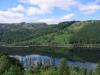
My concern was also about the "flat" feel of the map - I've never been there, but I when I think of Iceland I think of unique geological formations. This map looks very flat, and gives no sense of that. Just omething to consider.

Changes:
- Removed Papey
- Added Víðidalur
- Added an extra way to attack Heimaey and changed its name from Vestmannaeyjar
- Made some borders on the map a bit clearer
- Changed the islands to look like they do in reality (though a bit too big)
- This and that
I agree that the map looks flat, while Iceland really isn't, but I found no way to change that. If no one has a suggestion this will just have to be that way. I'm thinking about making the Veiðivötn - Ódáðahraun border impassable and perhaps Árnes - Kjölur also, it is hard to keep the bonuses.
It'd be nice if some mod removed the poll since I can't do it myself.

